North to Alaska
Updated Sept. 10, 2004
Our major journey this summer takes us to Alaska. We were there once before, but it was only a two-week trip and we only saw a small part of Alaska. This time we plan to spend the entire summer and to see more of Alaska and northwest Canada. We start out in May by heading to California for a genealogy meeting and to visit family. We then head north through Oregon and Washington to Canada. We will be using the British Columbia and Alaska ferry systems to visit towns in southeastern Alaska. At Haines, AK we head inland and drive through the Yukon to the main part of Alaska. Our route home is via the Klondike and Alcan highways to the Canadian Rockies, south through the Rockies to the U.S. and back home. We plan to return home sometime in mid-September. Except for the ferries and Denali National Park, we have no reservations and no specific itinerary; we will be planning the trip as we go.
As has become our custom, we will be maintaining this web page as we travel. As Internet access allows, we will be uploading photos and a "diary" of events, impressions, etc. to keep our family and friends updated on our trip.
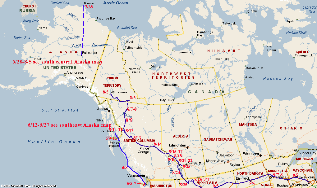
Where are we now? If you want to know,
click on the "thumbnail" to the left to see a map of Alaska, where we have
camped, and our current location. We are on this map prior to June 12 and
after Aug. 5. Since Alaska is so large, we also added
more detailed maps of southeast and south central Alaska.
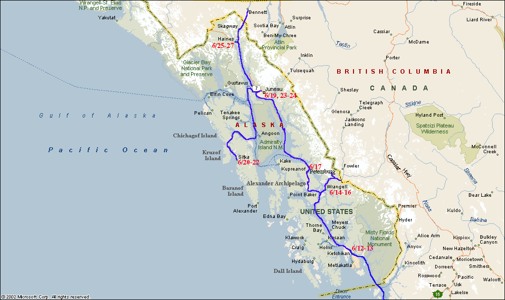 Map
of southeast Alaska showing our route and location. Click on the thumbnail to
the left to see the map. We were on this map from June 12 to June 27.
Map
of southeast Alaska showing our route and location. Click on the thumbnail to
the left to see the map. We were on this map from June 12 to June 27.
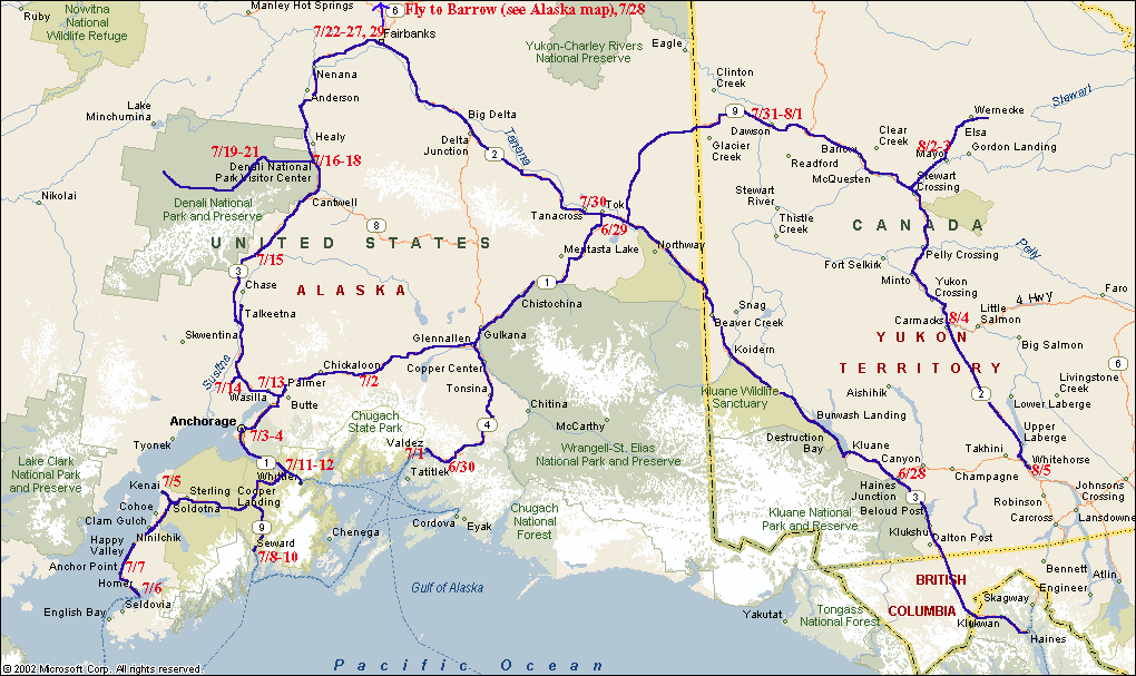 Map
of south central Alaska showing our route and location. Click on the thumbnail
to the left to see the map. We were on this map from June 28 to Aug. 5.
Map
of south central Alaska showing our route and location. Click on the thumbnail
to the left to see the map. We were on this map from June 28 to Aug. 5.
Photos and Experiences in Route: