Haines and Skagway
June 24-27, 2004
After Sitka we went back to Juneau and then on to Haines and Skagway.
Sightseeing in Juneau - been there, done that, it was OK the first time, but don't know why we should do it again. In addition, Juneau was overrun with people from four huge cruise ships. So we replenished supplies and limited our sightseeing to a visit to the Russian Orthodox church as a favor to a friend of Nancy; the friend's grandfather had helped construct the church and she wanted a postcard of it. Then we caught the fast ferry to Haines. Haines and Skagway are at the northern end of the Lynn Canal. I'm not sure why it was named a canal since this makes it sound man-made, but it was dug by glaciers and is said to be the largest and deepest fjord in North America.
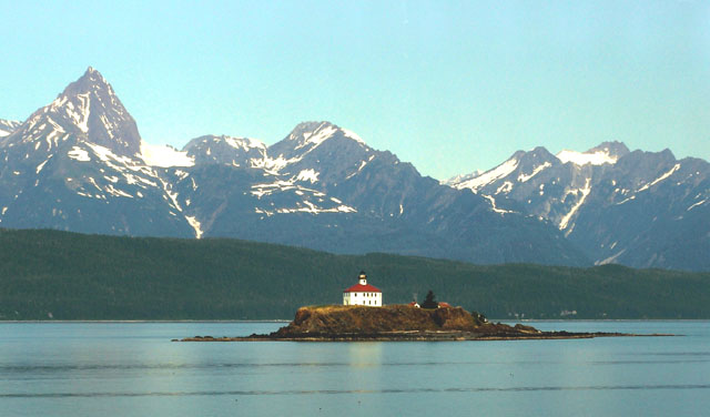
The lighthouse on Eldred Rock, about 15 miles south of Haynes.
The air was still smoky from forest fires in the interior, so views of the
mountains were hazy. We saw many humpback whales in this area, but they were too
far away to photograph. Also, taking pictures from the fast ferry is not so easy
since you go by everything at about 40 mph.
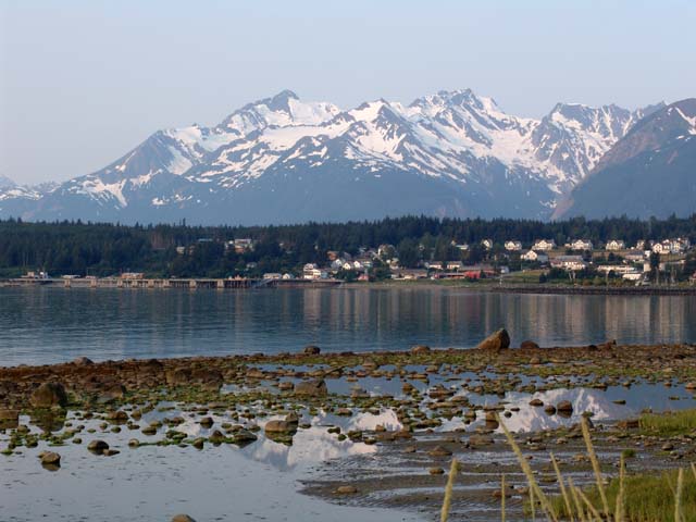
Haines lies at the foot of a beautiful range of glaciated and
snow-covered mountains.
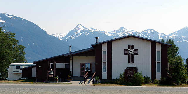
The Presbyterian church in Haines. Beth Dewey (from our church
in Madison) was a student
pastor in this church some years ago. What a beautiful place to work! We
attended church here on Sunday.
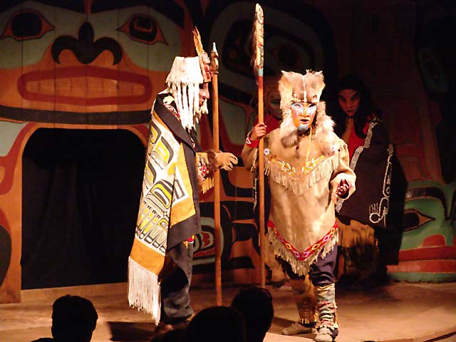
The Chilkat Dancers Storytelling Theater in Haines. They
portrayed Native American legends from the area. It was more theater than dance,
and I'm not sure how authentic it was, but it was entertaining.
As a one-day excursion, we took the local ferry to Skagway,
which is 15 miles away by water, but over 300 miles by car. The town of Skagway
was created by the 1898 Klondike gold rush. Many people heading to the
goldfields in Dawson (in the Yukon) came to Skagway by ship and then walked over
the Chilkoot trail to Lake Bennett, where they made boats and waited until the
ice went out. They then headed down the Yukon River to Dawson to seek their
fortunes. Now it seems that Skagway survives on tourism and is a major stop for
cruise ships.
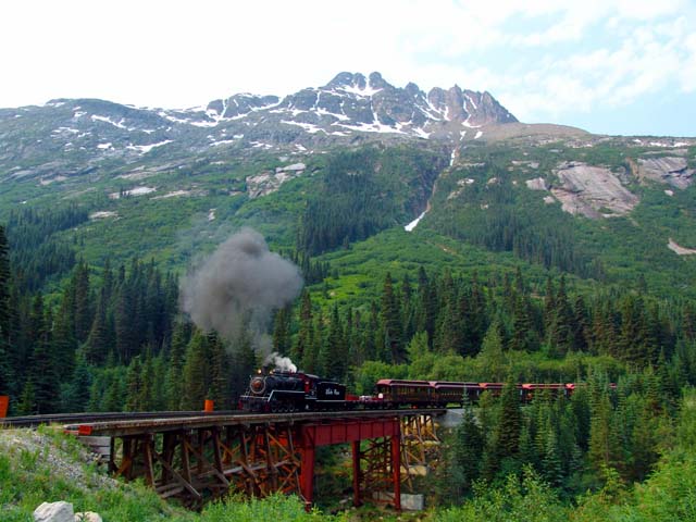
The White Pass and Yukon River railroad was built to
provide a better way to get to Dawson. It ran from Skagway, over the White Pass
summit, down to Lake Bennett, and then followed the Yukon River to Dawson.
Construction began in 1898 and was completed in 1900, about the time the gold
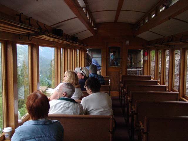
rush was over. Now the railroad carries only tourists. We rode the steam train
to Lake Bennett and back. The views of the mountains, canyons, rivers, and
glaciers were magnificent.
Hint - if you ride the train, the best views are on the left (as
you leave Skagway).
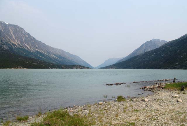
The site of the town of Bennett at Lake Bennett. 30,000 men
spent the winter of 1897-1898 here and built over 7,000 boats in preparation to
go down the Yukon River to Dawson when the ice went out. A year later there was
a sizeable town at this site. Now it is a ghost town with only rusting iron and
broken glass laying around. The buildings have been removed and "recycled". The
only residents are one First Nation family, and a few seasonal personnel from
Parks Canada.
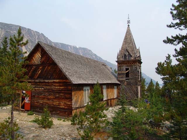
The Presbyterian church is the only remaining building from the
early town; it is being preserved by Parks Canada.
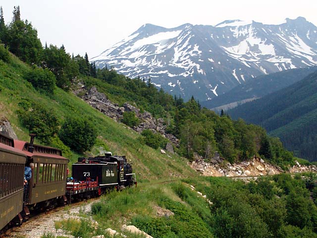
The ride back to Skagway. The steam engine ("Old 73") was built
in 1942.
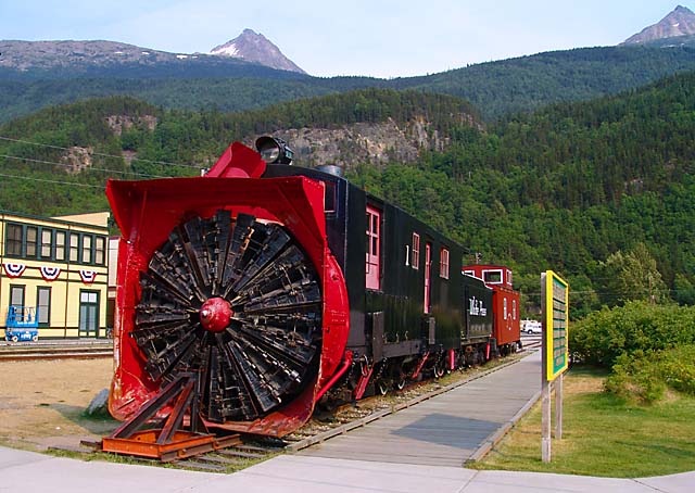
A rotary snow blower used by the railroad. This was in service from 1899 to 1964.
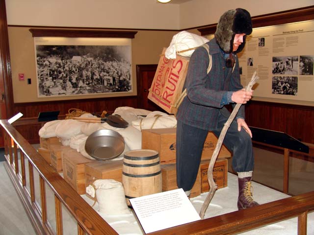
The railroad came too late for most of the "stampeders"; they
had to hike over the mountains to Lake Bennett. The Canadian government required
that all stampeders have enough provisions to last one year in Canada. This
display illustrates what one year's supplies looks like; it weighs about a ton.
To carry a ton to Lake Bennett, a distance of about 33 miles via the Chilkoot
trail, required 30-50 trips and took about three months.
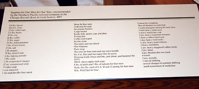
The recommended list of supplies for one year. Thankfully,
backpacking is not like this any more.
Next we head up the Haines highway to connect with the Alcan (Alaska-Canada) highway; this will take us back into Alaska.