
Haines to Valdez
June 28-30, 2004
Riding the Alaska Marine Highway ferries has come to an end for us and it is time to head into the interior. So we headed north on the Haines Highway into Canada. This highway follows the general route of the Tlingits' Chilkat trail. They used the trail for trade with Native Americans in the interior. In order to maintain their monopoly on this trade they kept the route over the mountains a secret. But Jack Dalton discovered the route and set up a toll road that became known as the Dalton Trail. This route didn't become popular with gold stampeders, but was used for moving livestock.
Can you believe this? If you look carefully, you will see that
the horse is wearing snowshoes!
Today, Haines Highway is a very scenic mountain road; at least that is what we are told, but we couldn't see much scenery because of all the smoke from the forest fires in the Yukon.
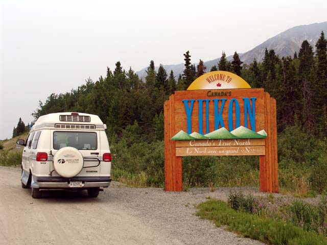
We crossed into the Yukon, which is the first time we have ever
been in this province.
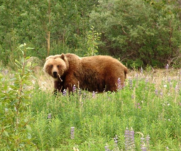
Along the way we came upon a traffic jam created by a grizzly
bear and her two cubs having an afternoon snack near the road. Although she
appears concerned about these humans, she tolerated our presence.
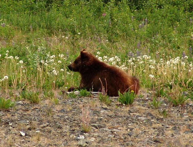
One of the two cubs.
Finally, we arrived in Haines Junction, YT and met up with the
Alaska Highway. This is at mile 985 (mile zero is in Dawson Creek, BC); the
highway officially ends in Delta Junction, AK at mile 1390. Fairbanks is 98
miles beyond Delta Junction.
After spending the night in Haines Junction, we turned north on
to the Alaska Highway. Paving of the highway was completed in 1992, but the
environment here is severe; thawing of the permafrost creates depressions that
make for a roller coaster type of ride, which gets tiring very fast. Frost
heaves also breakup the pavement, so repairs are continually needed.
Consequently, we had to drive on gravel sections in construction zones. The road
is generally rather bumpy and, even though the speed limit is 55 mph in most
areas, we were continually having to slow down to 30 mph or less to reduce the
bouncing of our van. The paving is what they call "chip-sealed"; it is similar
to our asphalt paving, but contains small stones, so the surface is rougher than
we are used to. Consequently you get a lot of road noise and low-level
vibrations from the road. It took us about seven and a half hours to go
300 miles - not exactly interstate driving, but much better than the old gravel
road.

North of Haines Junction, the Alaska Highway provides views of
the spectacular St. Elias Mountains; these mountains contain several very high
peaks, including Mount Logan, which at 19,521 ft is the highest peak in Canada.
But the forest fire smoke obscured all views. This is typical of what we saw for
300 miles.

A monument marks the U.S. - Canada border where the Alaska
Highway crosses it; the border is marked by a 20 foot wide swath in the forest
with concrete markers such as these. As I took this picture I was standing with
my left foot in Canada and my right foot in the U.S.
After spending the night near Tok, AK, we headed south on the
Tok Cutoff and then south on the Richardson Highway. Stopping at the visitor
center for the Wrangell-St. Elias National Park, we learned that it is the
largest national park in the U.S. - six times larger than Yellowstone. It
contains fantastic mountains with several peaks over 15,000 ft and most of them
clearly visible from where we stood - if it weren't for the smoke from the
forest fires which obscured all views of mountains.

The Trans-Alaska Pipeline runs from Prudhoe Bay on the Arctic Ocean
800 miles south to Valdez. The Richardson Highway comes close to the pipeline at
several points. About half of the pipeline is above ground; this is to prevent
thawing of the permafrost.
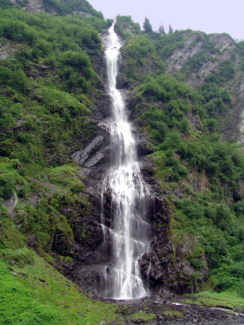
Bridal Veil Falls in Keystone Canyon just north of Valdez (they pronounce it "Valdeez" here, although the name has Spanish origins). I liked the stair-step nature of the falls.