Fairbanks to Dawson City
July 30-31, 2004
After coming back to Fairbanks from Barrow, it was time head southeast on the
Richardson Highway.
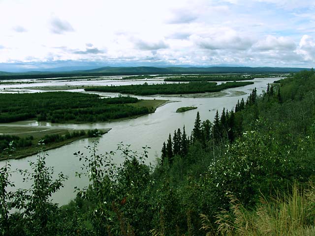
This section of the Richardson Highway generally follows the Tanana River, which is one
of the longest rivers in Alaska. The river is an confusing mass of channels and
islands in some areas.
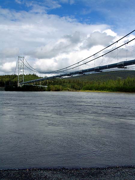
The Trans-Alaska Pipeline crosses the Tanana River on its own suspension
bridge.
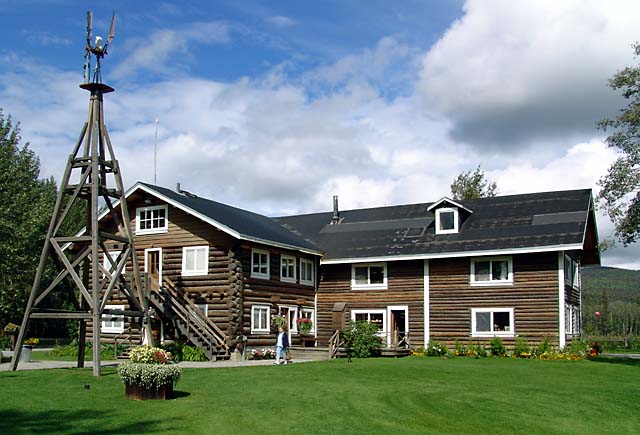
Rika's Roadhouse on the Tanana River. Roadhouses, such as this one, sprung up
about a day's travel apart (15-20) miles and provided lodging and meals for
travelers. Rika Wallen, a Swedish immigrant, operated the roadhouse from 1917
until the late 1940s and continued to live there until her death in 1969 - at
age 94. The roadhouse is now part of a state historical park.
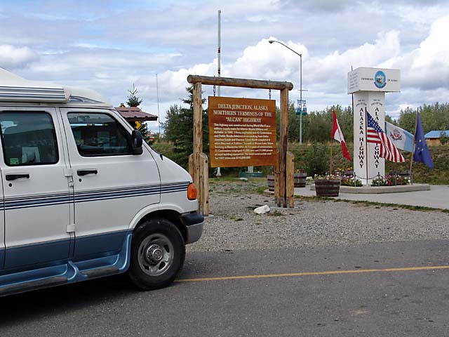
The next stop was Delta Junction, which is the northern terminus of the
Alaska Highway. This is Mile 1422, which is the distance from the other end at
Dawson Creek in British Columbia. The Alaska Highway is sometimes referred to by
its older name, "Alcan Highway" (i.e. Alaska-Canada), but Alaskans don't seem to
like that name. Actually, most of the Alaska Highway is in Canada.

At Delta Junction we turned on to the Alaska Highway, and soon came upon this
moose who was taking her sweet time crossing the highway.
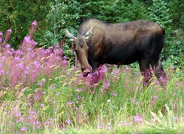
The moose was headed for this clump of sumptuous (if you are a moose)
fireweed. I can imagine her thinking, "Hey, buddy, can't you let a lady eat in
peace?"
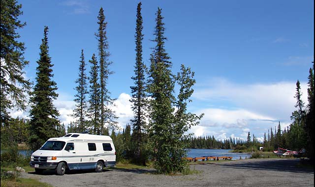
We stopped for the night near Tok, where we found a beautiful, and largely
unused, campground at Moon Lake. Our campsite was right on the water.
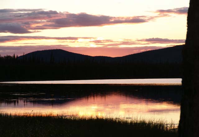
After experiencing the midnight sun at Barrow, it was nice to see a genuine
sunset on Moon Lake. This picture was taken at 10:27 pm , so we are far enough
south to see the sun set at a reasonable hour.

South of Tok we turned on to the Taylor Highway. This led us through one of the major forest fire areas this year in Alaska. Fortunately, the fire was out near the road so we were able to travel unimpeded. We did get to see some of the burn areas.
A couple of weeks earlier, travel on the Taylor Highway was restricted to
night-time hours, and people had to travel in caravans.

The Taylor Highway passes by Chicken, which is a little burg (summer
population of about 50, winter population of about 15), but is a standard
tourist stop, primarily because of the town's name. The story is that the
miners who first settled here wanted to name it Ptarmigan (which is the state
bird in Alaska), but couldn't spell it, so they settle on Chicken. In the local
slang, ptarmigans were often called chickens.
After Chicken we turned on to the Top of the World Highway, which took us to Dawson City, in the Yukon in Canada. Dawson City is the site of the Klondike gold rush of 1897-1898. More to come on that in the next web page.