Whitehorse to Hyder
Aug. 6-10, 2004
After Whitehorse we took the Alaska Highway east to Watson Lake and then
turned south on the Cassiar Highway. Our goal was to go to Hyder, AK to see the
bears at Fish Creek. Hyder is well-known as a place to see brown and black bears
feeding on salmon that are migrating upstream to spawn.
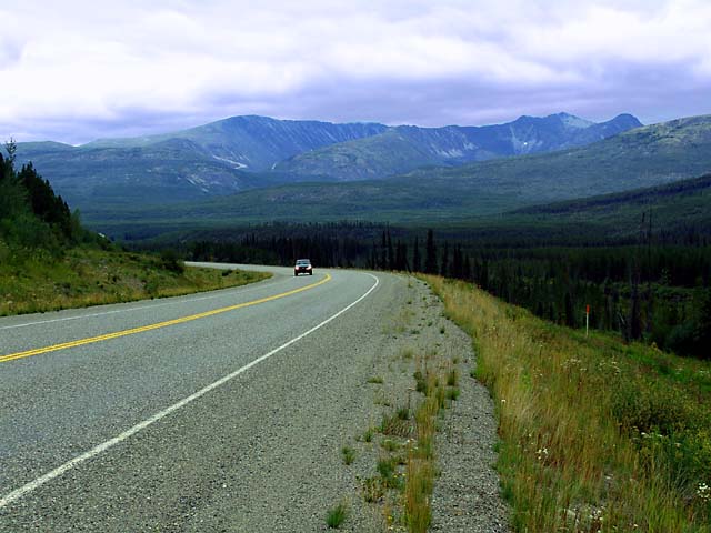
The Alaska Highway crosses the continental divide between Whitehorse and
Watson Lake. This view is just east of the divide. The divide is between the
Yukon river drainage to the west, which flows to the Pacific Ocean, and the
MacKenzie river drainage to the east, which flows to the Arctic Ocean.
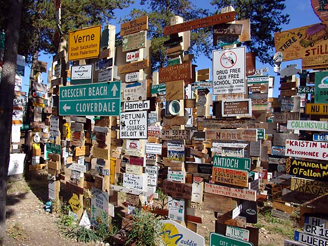
Watson Lake is well known as the location of the "sign forest". This was started by a homesick G. I. in 1942 during the construction of the Alaska Highway. He put up a sign to his hometown, Danville, IL. Others added their signs and soon a "sign forest" appeared. The tradition has continued to this day - travelers are invited to bring signs from their hometowns and add them to the collection. At last count (2003) there were over 50,000 signs. It is said that the collection grows by about 2,000 signs each year. Actually, there are not only road signs, but also car license plates, and homemade signs. We saw many signs from Europe, especially Germany.
Many of the signs look official; I wonder how many of these represent violation of laws concerning stealing or defacing public property.
No, we did not add a sign. Maybe next time.

We looked for a legitimate sign from Madison, but did not find one. However,
we did
find this sign from Merced, where I was born.

At Watson Lake we turned south on the Cassiar Highway and found an absolutely
gorgeous campsite on Lake Boya. We liked it so much we decided to lay over there
a day and do some kayaking on the lake.
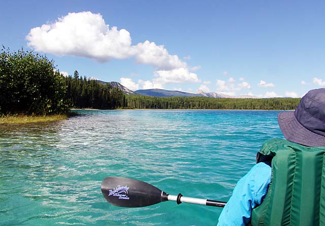
The water in Lake Boya is very clear and the lake bed is mostly a white
silt with little plant life. The result is that the lake takes on a
beautiful blue-green color. However, fishing is reported to be very poor here.
There were very few power boats on the lake; which made it a lot nicer for
kayaking.

Continuing south on the Cassiar Highway we came to some very scenic mountains. We are traveling due south, and thus getting closer to the coastal range along the Pacific Ocean.
The Cassiar Highway is about 80% paved and 20% gravel; this picture is taken
at the end of one of the gravel stretches.

Our next campsite was at Kiniskan Lake (we seem to make about 150 miles per
day). A herd of about 20 horses came running through the campground. The horses
were not being led by anyone and some of the horses wore "cowbells". It appears
that someone in the area is raising horses and allows them to roam unobstructed
for grazing. That may explain the "Watch for Livestock" signs we saw on the Cassiar Highway.
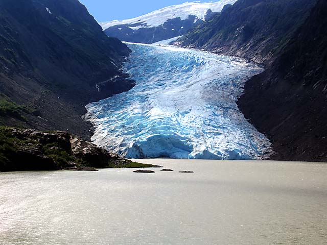
The road to Hyder passes by Bear Glacier. The road runs right next to the lake formed by the melting glacier so you get a very good view of it.