North Dakota Badlands
July
11- July 17
After Washburn we headed west on Highway 200A, which was
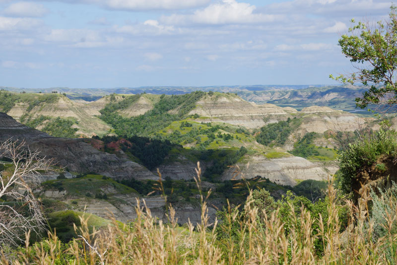
advertised as a scenic drive. This took us to Little Missouri State
Park, shown here. The geology is mostly sedimentary and arid.
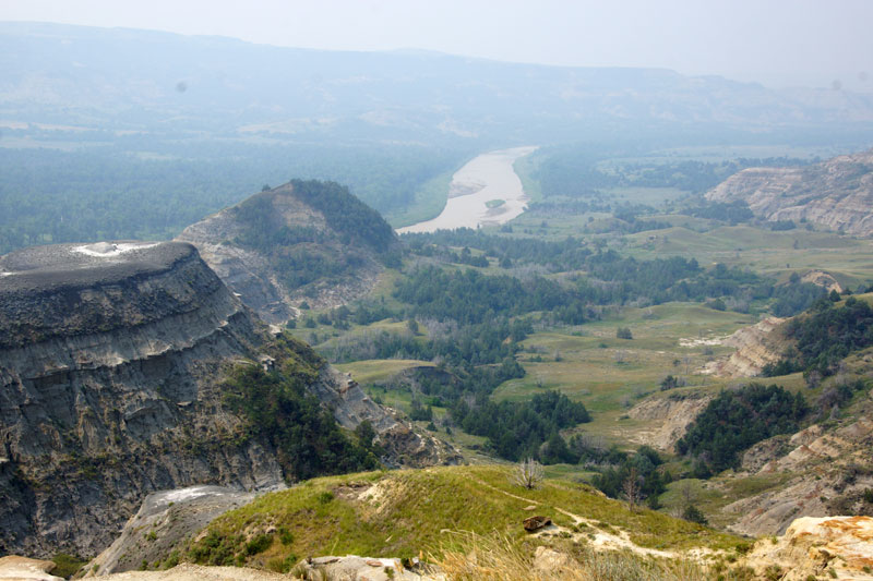
Nearby was our intended destination, the North Unit of Theodore
Roosevelt National Park. This view, which is from the Scenic Drive in
th park, shows the Little Missouri River in the distance. The haze is
due to smoke from fires in Canada.
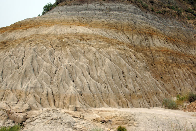
A close-up of the sedimentary layers. To a geologist, starting
from the top and going downward, is like reading history backwards in
time.
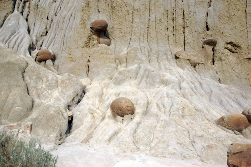
An unusual feature was these "cannon balls" lodged in the
sedimentary layers. Some "cannon balls" are two to three feet in
diameter. They are not real cannon balls, but are deposits formed
within the sedimentary layers and are being exposed by erosion of the
layers. It is not known why some are spherical.
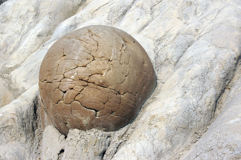
A close-up of one of the larger cannon balls.
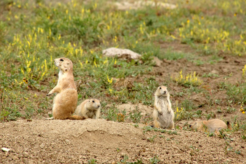
Prairie dogs on watch in their prairie dog town.
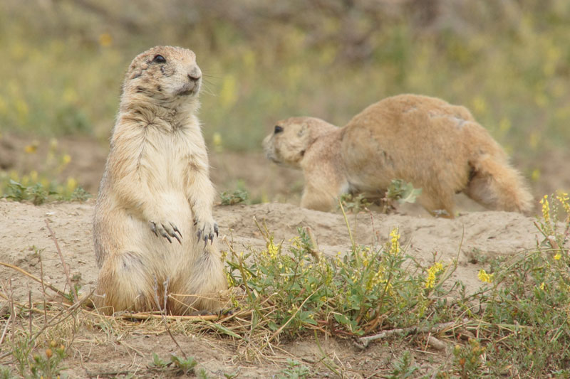
These prairie dogs seemed to be somewhat accustomed to people and
would let us get to within about 10 feet from them before they would
scamper down into their homes.

We saw only one bison during our three night stay in Teddy
Roosevelt national park. But one morning we saw this fresh buffalo
"paddy" in the campground near our site; it was not there the night
before, so we must have had a buffalo visiting us during the
night.
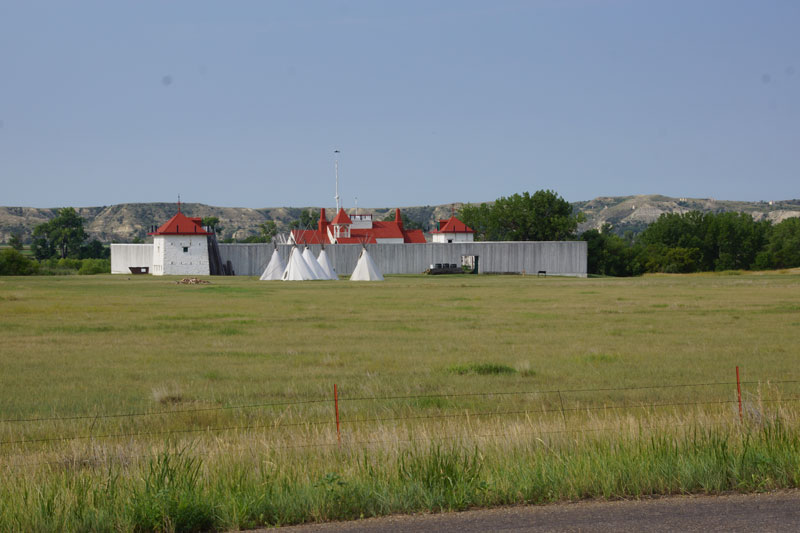
Fort Union, located near the confluence of the Missouri and
Yellowstone rivers, was an important trading post from 1828 to
1867. What you see now is a reconstruction.
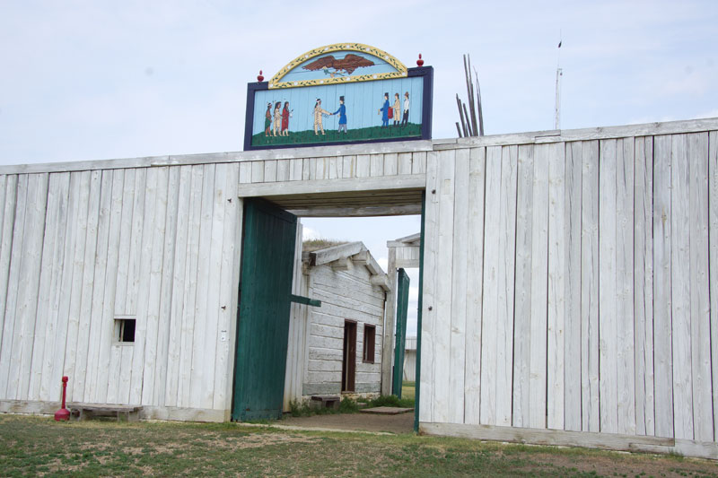
The main entrance to the fort. Having an inner gate as well as the
outer gate, allowed Indians coming to the fort to trade to enter the
trade house while restricting them from entering the courtyard. If the
outer gate was closed they could trade at the small window to the left
of the gate.
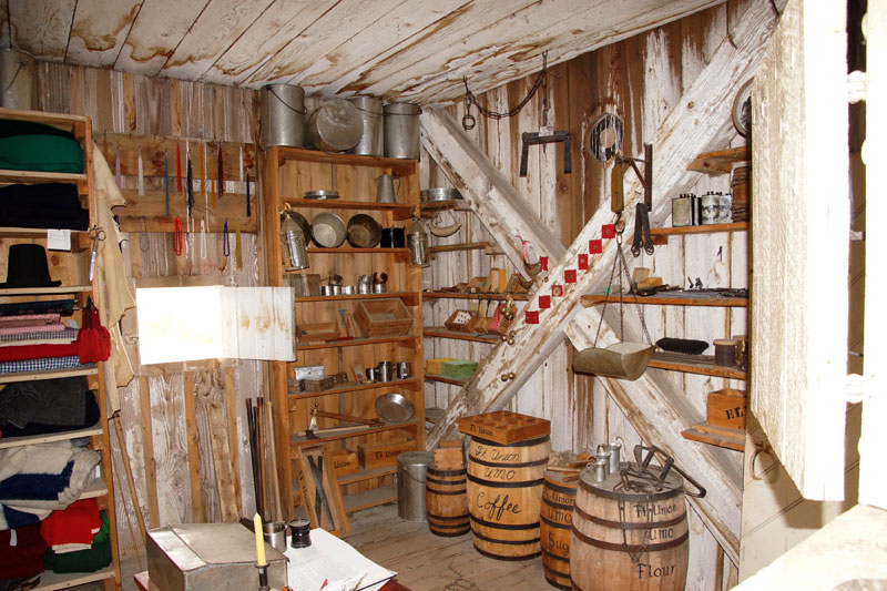
The trade house with goods for trading with the Indians for their
furs.
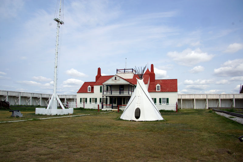
The courtyard and the Bourgeois House. The Bourgeois House was the
home of the bourgeois (agent in charge of the fort) and the chief
clerk. It also contained a central dining room for the bourgeois,
clerks, traders, and skilled laborers. At its peak, about 100 people
lived in the fort.
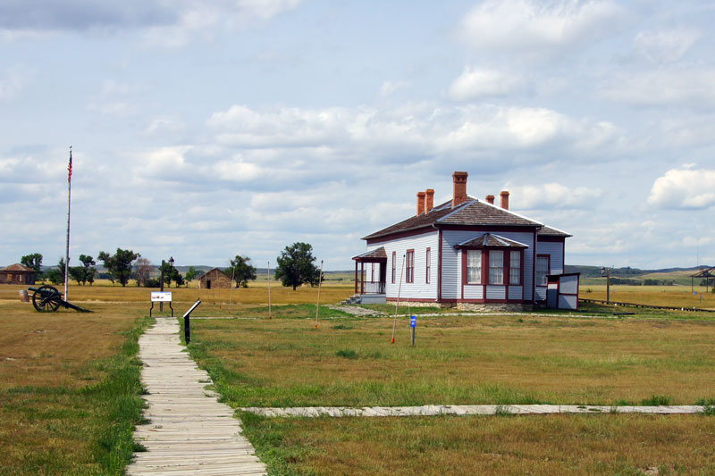
The officers' quarters at Fort Buford, which was located about two
miles from Fort Union. Fort Buford, which was a military fort, not a
trading post, was established in 1866 and decommissioned in 1895. The
officers' quarters was the site of the surrender of Chief Sitting Bull
in 1881.
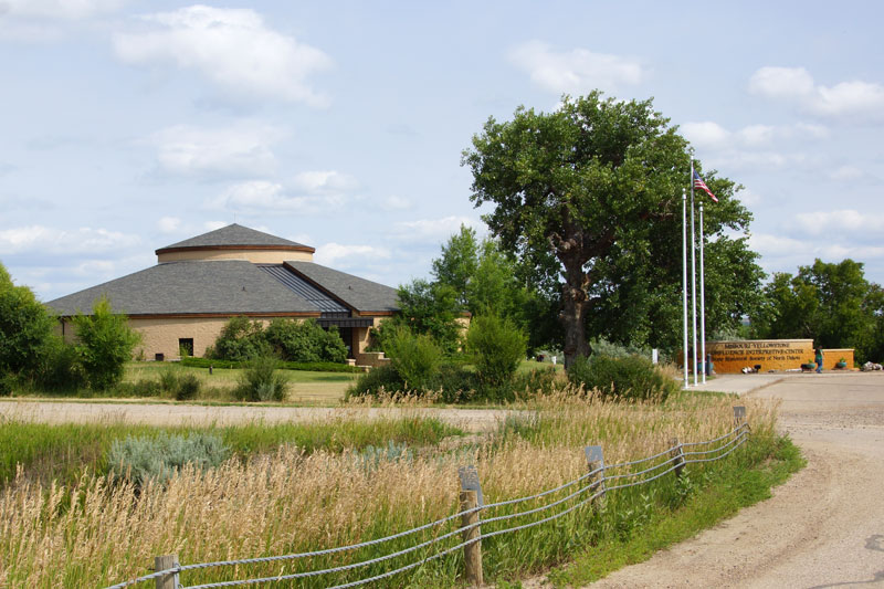
The Missouri - Yellowstone Confluence Interpretive Center, located
at the confluence of these two rivers houses a permanent gallery
depicting the history of the area, and a rotating gallery. The rotating
gallery currently features the life story of Chief Sitting Bull.