Discovering Lewis and Clark
Aug. 7-11, 2002
Aug. 7: Following the Salmon river north led us to the Lemhi valley
and the "Lewis and Clark Trail". Since it is getting close to the
Lewis and Clark bicentennial, the Lewis and Clark expedition has been getting a
lot of attention lately. Not wanting to be left out of all the fun, we starting
"following" the Lewis and Clark trail, but not quite in the order in
which they did it. First we headed south down the Lemhi valley to Tendoy, where
we turned on to a 39 mile gravel loop that lead us to Lemhi pass and back.
Lemhi pass on the Idaho-Montana border, looking into Montana. The pass is on
the Continental Divide. Lewis came up here in search of the Shoshone Indians in
the hope that he could purchase horses from them.

This spring is about a quarter-mile from the Lemhi pass summit - on the
Montana side. Lewis decided that this spring was the source of the Missouri
river. Following it downstream leads to the Jefferson river. The USGS puts the
headwaters of the Missouri and the confluence of the Jefferson, Madison, and
Gallatin rivers. Thus this waters runs into the Missouri.
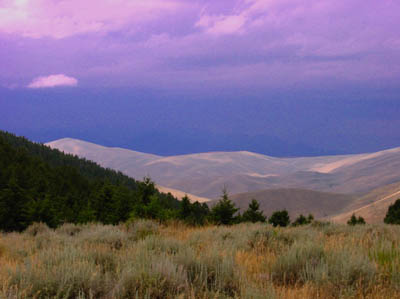
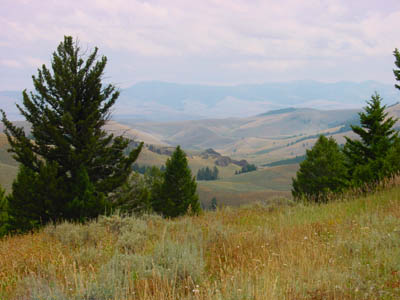
Looking into Idaho from Lemhi pass. When Lewis was here (Aug. 12, 1805) he
hoped to see the headwaters of the Columbia river and a plain leading to the
Pacific ocean. Instead he saw snow-covered mountains to the west and realized
that getting to the Pacific was tougher than he thought. The mountains on the
other side of Lemhi valley are hidden in storm clouds in this picture. Earlier
we saw rather barren mountains and no snow; apparently the area is experiencing
a drought and has not gotten much snow in the last few years. The Lemhi valley
below is where Sacagawea, the Shoshone woman accompanying Lewis and Clark, was
born and lived before being captured by another Indian tribe.

We then headed north along the Salmon river and followed it as it turned
west. This brought us to the Shoup townsite, where there is still a neat looking
store with old-fashioned gas pumps out front. It was like stepping back into the
Thirties. Unfortunately, the store was closed; this was their day off. Capt.
Clark, with an advance party, had explored the Salmon river as far as this
point, but decided the route was impassable and turned back.
Aug. 8: We also turned back (the road didn't go much further) and headed
north over Lost Trail Pass into Montana. Lewis and Clark came this way as well,
but their Shoshone guide Toby lost the trail and they missed the pass by a
couple of miles. The route from here leads north into the Bitterroot valley.
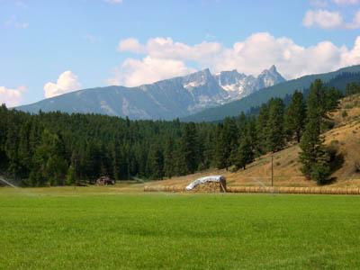
This is Trapper Peak, which, at 10,157 feet, is the highest peak in the
200 mile long Bitterroot range. Lewis and Clark passed along here and must have
seen these mountains as well.
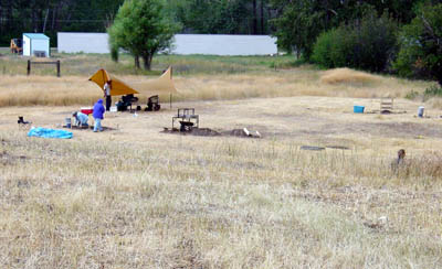
The next stop was Traveller's Rest State Park, near Lolo, MT. This is where
Lewis and Clark camped before heading west over Lolo Pass; They also stopped
here on their way back home. The state park is brand new, having opened in May.
Archaeologists are investigating the area and believe they have found Lewis and
Clark's actual campsite. The evidence supporting this is the presence of mercury
in the soil where they think the latrine was located. Lewis and Clark's medicine
supply included "Dr. Rush's Thunderclappers", which was mostly
mercury.
We drove up to the Lolo pass summit, but there wasn't much to see; the Lewis and Clark Visitor Center there is still under construction and will not open until October. There was no snow on Lolo pass when we were there, although Lewis and Clark were wallowing in snow in Sept., 1805.
Aug. 9: Next we headed for Great Falls; the falls were an important
landmark for Lewis and Clark since it confirmed that they were still on the
Missouri river. Lewis arrived here on June 13; they discovered there were 5
falls, not one fall as they expected. It took them 2 weeks to get all their gear
over the 18 mile portage. I'm glad we don't take that much stuff on our Boundary
Waters canoe trips!
The Missouri river at Great Falls, MT. The falls are no more; they have been
flooded, or otherwise destroyed, by dams and reservoirs. There is an excellent
Lewis and Clark center in Great Falls.
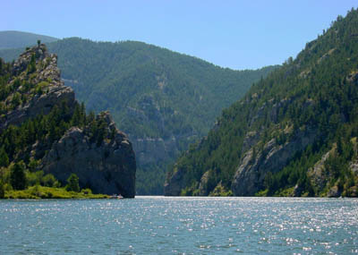
Aug. 10: The "Gates of the Mountains", as Lewis called this
region on the Missouri river, south of Great Falls. The cliffs go up to 1200
feet high and it appears that you are going into the mountains as you enter this
gorge. We took the boat tour through the area; it was very well done and the
scenery is great.

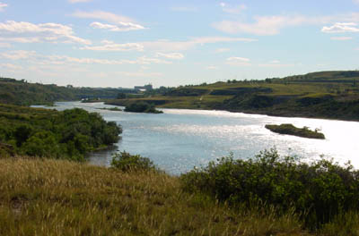
The next stop was the Three Forks area, where three rivers come together to
form the official start of the Missouri river. The picture shows the Madison
river coming in from the left, the Jefferson river coming in from the center,
and the Missouri flowing out to the right. About a half mile downstream, the
Gallatin river joins the Missouri. The Shoshone woman, Sacagawea, recognized
this area when they arrived here; she said that this is where she was captured
by another Indian tribe. Lewis and Clark debated over which fork to follow and
chose, correctly, the Jefferson fork.
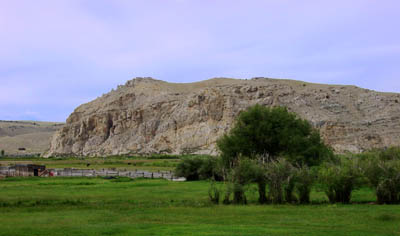
Aug. 11: Following along the trail of Lewis and Clark, we came next to
Beaverhead rock, which Sacagawea had recognized as an important landmark for the
Shoshone. She then knew that her home tribe was in the next valley over the
mountains to the southwest. This rock is supposed to look like a swimming
beaver. Does it look like one to you?
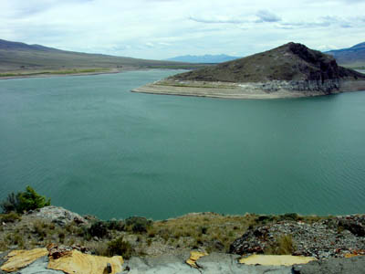
The next landmark on the Lewis and Clark trail is Camp Fortunate. This is
where Clark camped with the main group while Lewis took an advance party over
Lemhi pass in search of the Shoshone. He met up with them and
brought the Shoshone chief, Cameahwait, back to Camp Fortunate. When they
started negotiations over purchasing horses, Sacagawea, who was serving as an
interpreter, recognized Cameahwait as her brother, and consequently, he was
agreeable to selling horses to Lewis and Clark. Camp Fortunate is believed to be
under the present Clark Canyon reservoir, about half way between the near
shoreline and the island.
That is enough Lewis and Clark history; next we head south to the Tetons to see some real mountains.