June 26-28, 2013
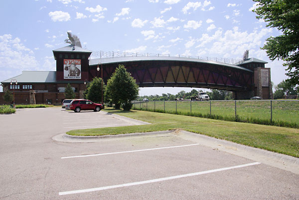
For several years we have driven I-80 under the Great Platte River Road Archway Monument without stopping. Since it focuses on the westward expansion era, we stopped this time.
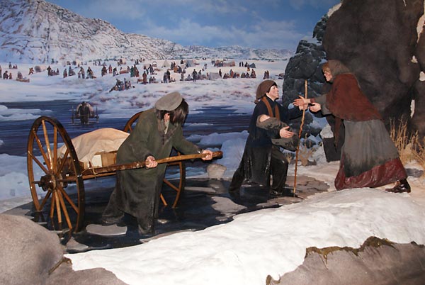
Inside was a multimedia experience focusing on the westward expansion history of our country. This diorama depicts the Mormons on their way to Utah who got caught in a snow storm. Note the carts they are pulling.Yes, many of them actually pulled handcarts from Illinois to Utah. The Archway was interesting and well worth a visit.
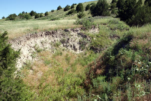
Further west, we came to Windlass Hill, where this 8 foot deep ravine was caused by wagons coming down a steep slope.

A cartoon on a display at Windlass Hill depicting the scary task of getting wagons down steep hills.

Another display debunking the legend of Windlass Hill.
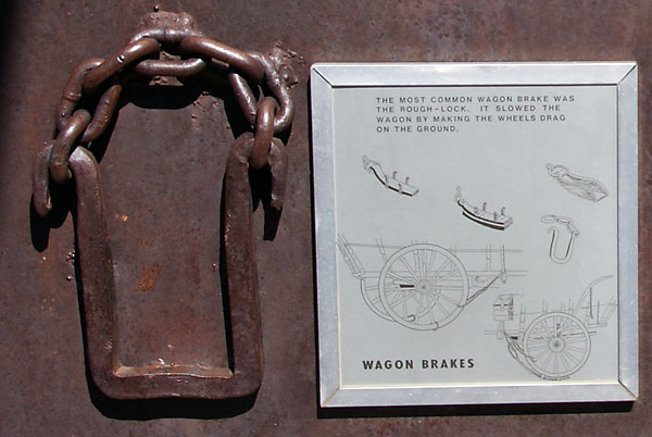
The more accepted way of getting down steep slopes was to lock the wheels so the wheels skidded rather than rolled as the wagon descinded. This skidding will cause deep ruts, which can be further enlarged by water runoff, hence the ravines. It seems plausible that they also used ropes snubbed around trees to slow the wagon, as we read at a steep slope in Idaho.
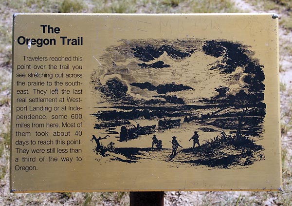
At this point we are about 600 miles from the start of the Oregon Trail in Independence, MO. Taking 40 days to get here, means they were averaging 15 miles per day. Most emigrants actually walked alongside the wagons to reduce the load on the oxen pulling the wagons; only the very young or the seriously ill rode in the wagons.
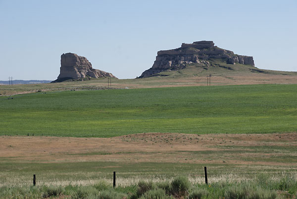
Courthouse and Jail Rocks, as these were known, is one of the prominent landmarks along the Oregon Trail.
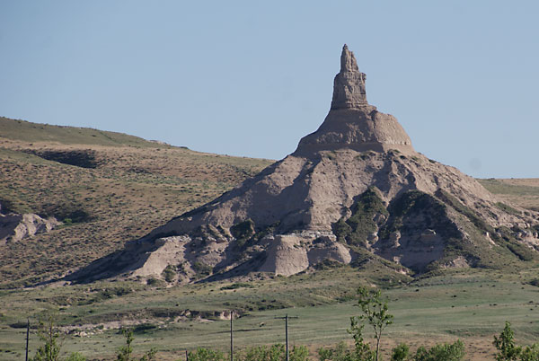
Chimney Rock was another prominent landmark. It rises 470 feet above the North Platte River valley. According to a volunteer in the Scotts Bluff National Monument, Chimney Rock was much higher at the time of the wagon trains. He said that, according to local legend, the Army used Chimney Rock for target practice and knocked off the top one-third. Then a lightning strike knocked off another third. It is still a pretty prominent landmark; we were able to spot it 25 miles away.
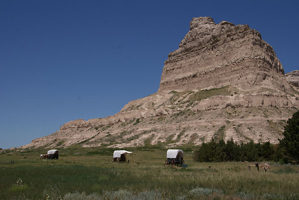
These covered wagon replicas were set up along the historic route of the Oregon Trail at the top of Mitchell Pass, which was a shortcut through the bluffs that are now part of the Scotts Bluff National Monument.
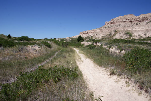
Oregon Trail ruts in Mitchell Pass. The rut on the left is from the emigrant wagon trains; the one of the right has been widened by modern day visitors to the National Monument looking at the ruts.
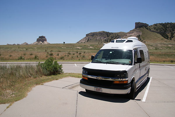
Our "covered wagon" at Scotts Bluff National Monument; it is much more comfortable than the real covered wagons, and we usually make much than 15 miles a day, since we can ride inside rather having to walk alongside it.