From Death Valley to Yosemite Valley
Oct. 3 -5, 2006
Leaving Zion we decided to go
through Death Valley and Yosemite Valley national parks on our way to
Merced, CA. I had not been in Death Valley for almost 50 years, and the
beauty of Yosemite always draws us back there.
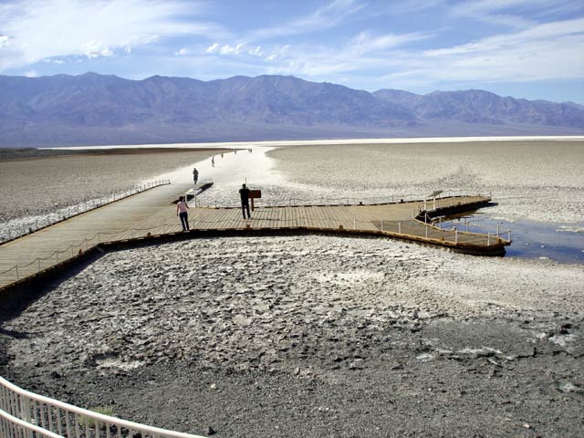
Badwater, at 282 feet below sea level, is the lowest point in the
western hemisphere. It is basically a salt flat produced by winter
snows from the surrounding mountains, which are as high as 11,000 feet
above sea level, produce runoff that drains into the area and
evaporates. There actually is a small pond at Badwater; according to
legend, an early surveyor in the area tasted the water and said, "Yuck,
bad water!" The name has stuck. The water is not poisonous, but is very
salty, giving it the bad taste.
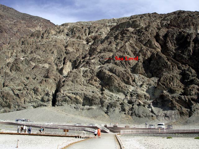
The rock cliff behind the parking lot at Badwater; a sign on the cliff
marked sea level. It didn't show up in the photo, so I added the text
to show where sea level is.
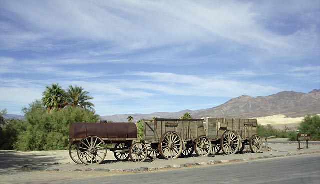
A 20 mule team wagon train from 1865; these wagon trains were used to
transport borax to the railroad at Mojave, CA, which is 165 miles away.
A train load of borax weighed 24 tons. Reminds me of an early TV
show.
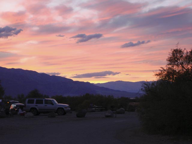
We camped for the night at Furnace Creek. Isn't that a reassuring
name(:-)? Furnace Creek is 190 feet below sea level. We were treated to
a beautiful sunset. The high temperature that day was about 97 degrees;
at sunrise the next morning the temperature was 82 degrees. Since this
is desert (annual rainfall of 2 inches per year), I had expected it to
cool off much more than that at night. However, because of the dryness,
82 degrees was quite comfortable.
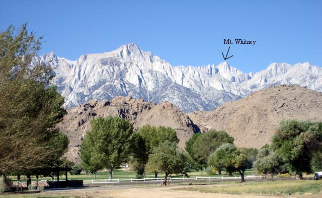
Leaving Death Valley, we passed through Lone Pine, CA, which is the
jumping off place for those wishing to climb Mt. Whitney, the highest
point in the lower 48 states (14, 497 feet above sea level). From this
view point, Lone Pine Peak looks higher, but it is actually 1500 feet
lower.
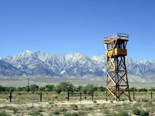
Just north of Lone Pine, we came upon the Manzanar internment camp,
which was used to house Japanese aliens and American-born Japanese
citizens during World War II.
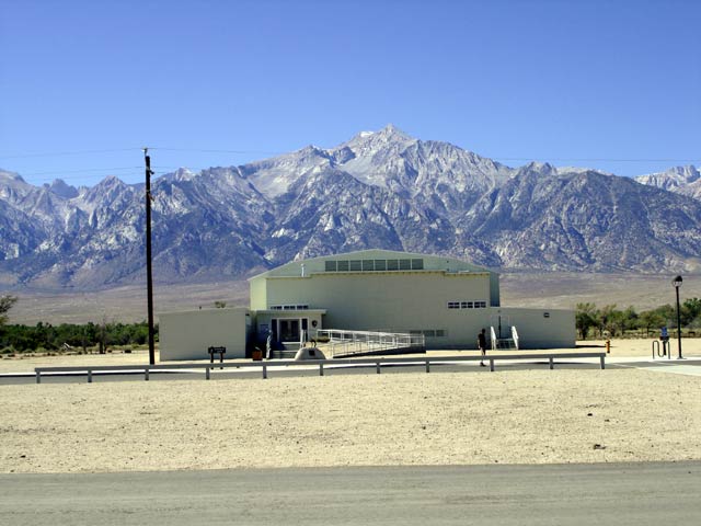
The only remaining building at the camp is the old high school
auditorium; it is now being used as an interpretive center. We learned
that over 110,000 Japanese were forcibly relocated from the coastal
regions of the western states to 10 internment camps inland. This camp
held as many as 11,000 people.When the Japanese were told to go, they
could only take with them what they could carry; they were forced to
abandon homes and businesses. When it was all over and they were
allowed to leave the camp, they were given a wallet with $25 and a
ticket to wherever they wanted to go - that was all. During the Reagan
administration the government finally acknowledged formally that the
whole relocation effort was wrong and a grave injustice and paid
restitution to the relocated Japanese that were still living. I left
the interpretive center with a lump in the throat and watery eyes; it
was a moving experience that left me ashamed for what my govenment had
done.
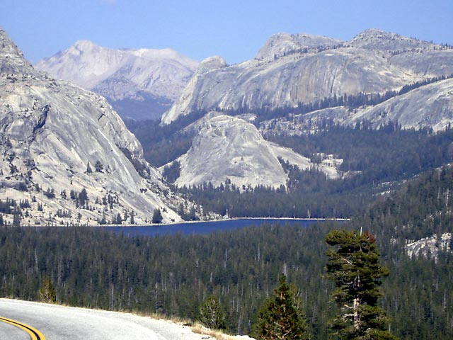
After Manzanar we headed north, and then west over Tioga Pass into
Yosemite National Park. This view is from Oelmsted Point on the Tioga
Pass road and overlooks Tenaya Lake and the surrounding mountains.
We camped at Crane Flat at the western end of the Tioga Pass road. The
next day it was raining so we couldn't see much in Yosemite Valley.
So we headed to Merced to visit my brother and sister-in-law.