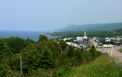
After visiting Chambly we headed north along the St. Lawrence River to the Gaspe peninsula. The terrain became more mountainous and the coastline more rugged, the further north we got. It reminded me somewhat of driving along Highway 1 in northern California, but with a few significant differences:
1) It is much greener here.
2) For most of the route, the highway stays down near the water level, rather than being several hundred feet above it.
3) There are more small villages here, which add interest but slows down the driving.
The area must depend largely on tourism for the economic base, although you see farming in the southern end of the peninsula and evidence of logging in the more forested northern end. There are a lot of campgrounds and small inns and motels, but hardly any large resorts.
This is still Quebec and the language here is French. While the rest of Canada tries hard to be bi-lingual, that is not the case in Quebec. For example, very few traffic signs are bilingual. The only bilingual ones I noted were on the major expressways around Montreal. Canadian flags are few and far in-between; Quebec flags are much more common.
Being a non-French speaking person has not been a problem, however. There always seems to be someone around who speaks enough English that they find a way to take your money, and you get in exchange what you were seeking. The people have been very pleasant and welcoming to us.

One of the many small villages on the St. Lawrence side of the Gaspe peninsula.

We stopped at the Reford Gardens in Grand-Metis. These are quite lovely, and
well worth the stop.
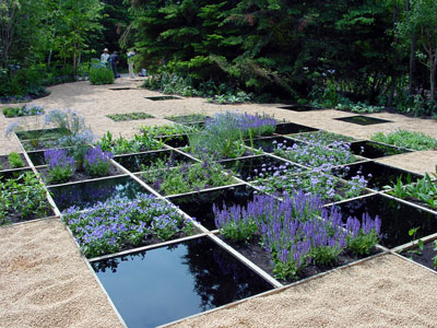
The Reford Gardens hosts an International Garden exhibit, where they invite
different countries each year to set up a special garden. These international
gardens tended to be rather avant garde. This garden was composed of squares of
flowers intermixed with square pools of water and set in a field of cherry pits.
I found it both interesting and attractive. But it smelled a bit like cherries.
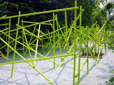
One of the other international "gardens" looked more like a playground to me.
It was PVC tubing wired together to form a maze and set on a sand bed, with
little in the way of plants or flowers.
We left the shoreline to visit the "Gaspe National Park" in the interior of the peninsula. Various guidebooks claimed that it was well worth seeing, since it is the northern end of the Appalachian chain of mountains and supposedly had beautiful mountain scenery and a lot of wildlife, especially moose. That turned out to be a mistake. After seeing the Rockies or the Sierras, the Appalachian mountains are not that exciting. Furthermore, it was hot and buggy, so we retreated the next day back to the shoreline and continued on around the Gaspe peninsula.

Forillon National Park at the eastern tip of the Gaspe peninsula, so one
could call this "Lands End". In fact, "Gaspe" is derived from "Gespeg",
which is the Mi'kmaq word for "lands end". The Mi'kmaqs were an Amerindian tribe
in the area. "Amerindian" is used by the Canadians to denote native tribes of
North America.
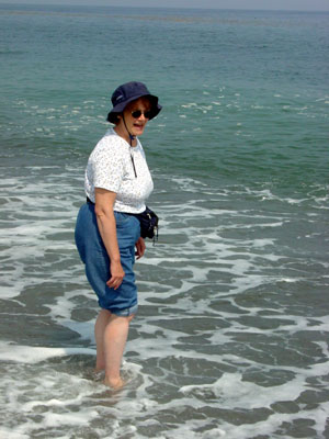
Nancy decided the water was too C-O-L-D and changed her mind about walking to
Newfoundland. (:-)
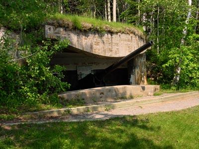
During World War II, German U-boats entered the St. Lawrence Seaway and started torpedoing ships so Canada decided that it had better start defending its coastline and providing escorts for commercial shipping in the St. Lawrence Seaway. They put a naval base at the end of Gaspe bay and built a few forts with artillery along the shore to protect the base from enemy ships. This gun is at Fort Peninsule, which is now part of Forillon National Park. The fort is totally gone except for the concrete bunkers for the gun emplacements. After all this trouble, the guns were never used to fire on enemy ships.

The village of Perce on the Gaspe peninsula. Perce had more of a resort feel to it than most villages along the coastline. The scenery, with mountains coming down to the sea, and interesting off-shore rocks, is rather dramatic.