
Down the Columbia
Aug. 28-31, 2003
After Lewiston, we headed across the southeast corner of Washington to the Columbia River and then followed the river to the Pacific Ocean
We saw this unusual trail sign in Pomeroy, WA. Lewis and Clark came through
here on their way back to St. Louis. Apparently, the people in Pomeroy think
that the route east is being overlooked in all the Lewis and Clark hoopla.
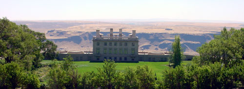
The next stop was Maryhill Museum on the Columbia River. This was intended to
be the home of Sam Hill, a railroad tycoon from Seattle. However, he died before
the home was finished, so it was converted to an art museum. It is a nice
museum; I especially liked the native American art.

I found the juxtaposition of these two photos by Chuck Williams (a member of
the Cascade tribe) to be especially moving. To me they portray our effect on the
native American Indians. The dams along the river have ruined areas where
Indians have fished for thousands of years. The title of the photo on the
right is "Ghosts of Celilo Past: The Lone Pine Shaker Village and the Dalles
Dam." (I forgot to write down the title of the photo on the left.)


Celilo Falls is a famous waterfall and Indian fishing area on the Columbia a few miles upstream from the Dalles. The photo on the left in the roadside sign shows what it looked like before the Dalles Dam was built; the photo on the right shows what the area looks like now, with the lake behind the dam completely covering the falls. The Columbia is one dam after another, with little free-flowing river in between.
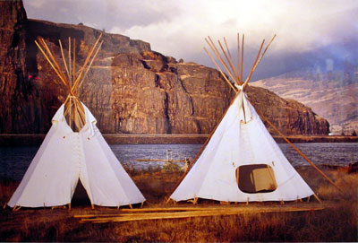
Since Labor Day weekend was about to pounce upon us, we decided to lay over a couple of days at Maryhill State Park, which is on the Columbia near the museum. It gave us a chance to rest; it also let us try out my new toy - an inflatable kayak that I had purchased in Missoula. It worked pretty well, but Nancy and I need to work on our paddling technique; getting it to go in a straight line was a problem. Maybe I should buy a rudder for it!
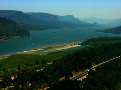
As we made our way downstream, we got out of the rain shadow of the Cascades
and the scenery greened up considerably; compare this photo with the previous
one. Beacon Rock, which was mentioned by Clark in his journal, is in the
distance on the opposite shore. Near Beacon Rock they observed tides influencing
the river; this was indication they were approaching the Pacific Ocean.

Multnomah Falls, on the Oregon side of the Columbia River. This area is said
to have the highest density of waterfalls in the U.S.

Mt. Hood, 22 miles away, is visible from many spots along the Columbia River;
this picture was taken from Larch Mountain, which is a short detour that affords
a view of several of the higher mountains in the Cascades. Mt. Hood was a signal
to Lewis and Clark that they were approaching the Pacific Ocean, since it had
already been sighted and reported on by explorers coming to the Columbia by sea.
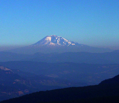
Mt. Adams on the Washington side. Mt. Rainier and Mt. St. Helens, at least what is left of it since it exploded in 1980, were also visible.