
Crossing the Idaho Mountains
Aug. 26-27, 2003
After Great Falls we left the Missouri River and headed west across the
continental divide and along the Blackfoot River to Missoula. Lewis came this
way on his trip back to Saint Louis in 1806. We didn't have to worry about
Blackfoot Indians, like Lewis did, but we did have to be a little bit concerned
about forest fires. As we approached Rogers Pass on the continental divide, we
encountered a lot of smoke in the air. The campground on the western slope where
we planned to spend the night was taken over by crews fighting the forest fires
in the area, so we had to go further to camp. Fortunately there was a town park
in Lincoln that allowed overnight camping so we stayed there. The air in Lincoln
was not very smoky, but we could see smoke billowing up from the forest fire on
the ridge to the north. The wind must have shifted during the night since it was
very smoky the next morning and the ridge to the north was no longer visible.
We spotted this wood carving of Meriwether Lewis and his dog, Seaman, just
east of Missoula.
After Missoula we headed towards Traveler's Rest State Park, which we had discovered in our travels last summer. The archaeological investigation of Lewis and Clark's campsite that was going on last year has been completed and they now have a nice self-guided trail describing the campsite. We then headed up towards Lolo pass with the intention of stopping at the Lewis and Clark exhibits at Howard Creek and Lee Creek and taking a short stroll on the trail used by Lewis and Clark. Unfortunately, these areas were closed because of forest fire activity in the area, so we headed over Lolo pass and camped at the Powell campground on the western slope. This is where Lewis and Clark killed a colt to have enough food for the men to eat. They were following an Indian trail which stayed mostly on the ridges since the river canyons were impassable. However, there was little game up high so they sometimes came down to the river in search of food. There was also little game in the valleys so they had to resort to eating horsemeat on occasion.
![]()
The confluence of the Lochsa and Selway rivers to form the Middle Fork of the
Clearwater River. Lewis and Clark passed near here on their way west and again
in June 1806 on their return journey. They got hit by early snows in September
1805, and found the travel very rough going We were here only three weeks
earlier in the year than when they were here, and saw no sign of snow, not even
up on the mountains.

A 70 foot mural on the wall of a grocery store in Kooskia, showing Lewis and
Clark encountering the Nez Perce.

A forest fire burn along the Clearwater River near Kamiah. We were told that
the forest fire occurred about a week ago and forced closure of the highway that
we were driving.
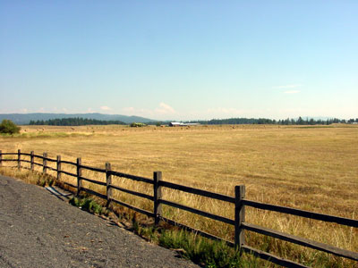
The Weippe prairie where Clark stumbled out of the mountains and first
met the Nez Perce. The Nez Perce treated the Corps of Discovery well, providing
food and showing them how to make dugout canoes by burning the wood.

Lewis and Clark arranged for the Nez Perce to take care of their horses for
the winter and made dugout canoes, similar to this one, so they could continue
on their journey to the Pacific Ocean.
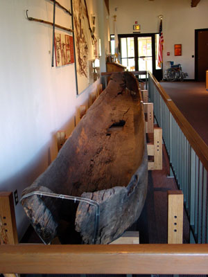
This 32-foot dugout canoe, which is in the Nez Perce visitor center in
Spalding, was made by the Nez Perce in 1837 and given to Spalding, who was a
missionary in the area. Note that it has much thinner walls than the dugout
canoe made by the interpretive center staff in Washburn, ND.
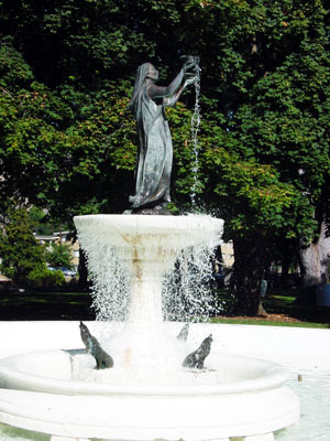
This "playful" fountain of Sacagawea is in Lewiston, ID, which is where the Clearwater River joins the Snake River.