Mandan and Hidatsa Indians in North Dakota
Aug. 21-22, 2003
Continuing up the Missouri River we entered North Dakota. The
first stop was Fort Abraham Lincoln State Park just south of Bismarck. Inside
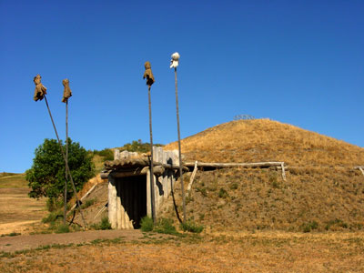
the park is an old Mandan village, called "On-a-Slant Village ". Lewis and Clark
stopped here on their way north; at that time the village was already abandoned.
When they met the Mandans later, they were told that it was occupied by the
Mandan Indians for about 200 years until smallpox decimated the tribe in the
1780s. The Mandans then moved further north and established villages in the
Knife river area near the Hidatsas. On-a-Slant Village has been partially
reconstructed to show how the tribe lived.

A Mandan earth lodge. It was about 40 feet in diameter and would
house about a dozen people. The lodge was built from logs providing interior
support, then covered with willows woven together, grass, and then dirt. We were
told that a lodge such as this would last about 10-15 years.
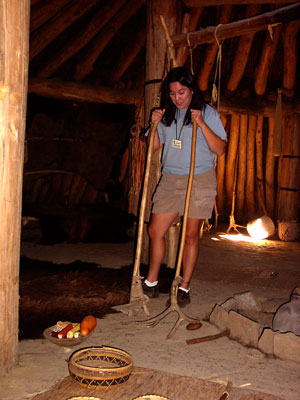
Our guide demonstrating various Mandan tools inside the earth
lodge. At the end of the tour we learned that she is about half Indian,
primarily a mixture of Mandan, Hidatsa, and Arikara.
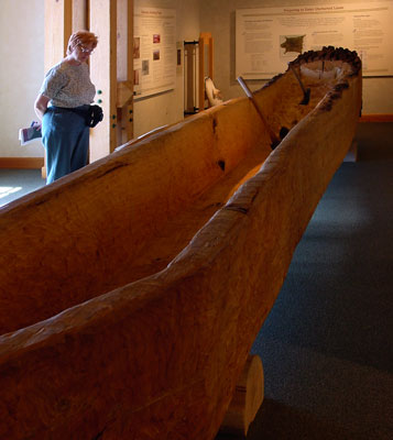
Next we drove along the Missouri river to Washburn where there
is a new Lewis and Clark interpretive center (that is now the "in-word, we used
to call them museums). A highlight of this center was the dugout canoe, which
had been made by center staff from a cottonwood log. That looks like a lot of
work to make a canoe. Lewis and Clark made dugouts similar to this for their
journey further up the Missouri.
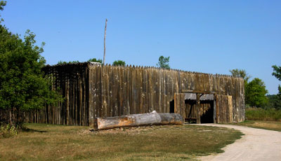
The center also has a reconstruction of the fort that Lewis and
Clark built a few miles from here; the original Fort Mandan, as it was called,
was their winter home in 1804-1805. It was located near the Mandan and Hidatsa
villages on the Knife River. This fort is built to the same dimensions as the
original fort.
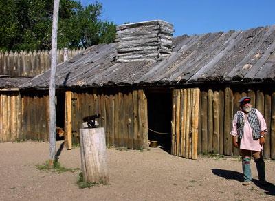
The interior of Fort Mandan. It was pretty small quarters for
about 45 people from November, 2004 to April, 2005.

This field along the Knife River is the site of an old Hidatsa
village; each depression is where an earth lodge was located. This village is
believed to be where Sacagawea was living before her husband Charbonneau was
hired by Lewis and Clark to serve as an interpreter. Sacagawea was Shoshone, but
had been captured by the Hidatsas as a young girl and later became one of
Charbonneau's wives. She accompanied the Corps of Discovery on their trip west
and was instrumental in their acquiring horses from the Shoshone for getting
over the mountains to the Columbia River basin.

The Garrison dam in North Dakota forms an immense reservoir named Lake Sakakawea (this is the preferred spelling in North Dakota). The original riverbed of the Missouri is beneath the reservoir. This picture was taken near New Town, ND, which is on the Fort Berthold Reservation; this reservation has Mandan, Hidatsa, and Arikara Indians. New Town is the location of the Three Tribes Museum, which has a nice display of the history of these three tribes and their adjustment to being on a reservation. When Lewis and Clark passed through what is now western North Dakota they wrote in their journals that the area was very windy. Sometimes the wind was favorable, and they could raise their sails and move upstream under wind power. But often the wind was too strong and they needed to lay over on shore until it subsided. I can easily understand that; the wind was strong as we drove through the area. It blew our Roadtrek around some and we needed to slow down to stay on the road!