Ketchikan
Sept. 4-6, 2008
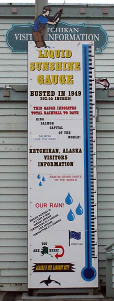
The rain gauge on the side of the Ketchikan visitor center. It rains
here a lot - an average of 150 inches per year, with a record of 202
inches in 1949. Although it wasn't raining our first day here, it was
still pretty dreary weather. Oh well, this is the norm for Alaska this
year.
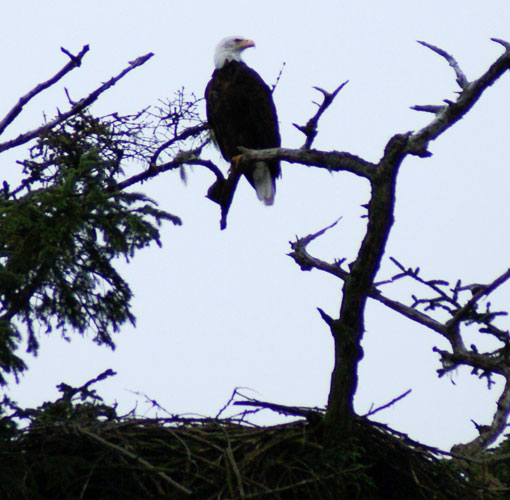
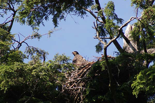
Despite the weather, we booked a boat tour of the Misty Fjords National
Monument. This eagle was spotted along the way, perched above his
(her?) nest.
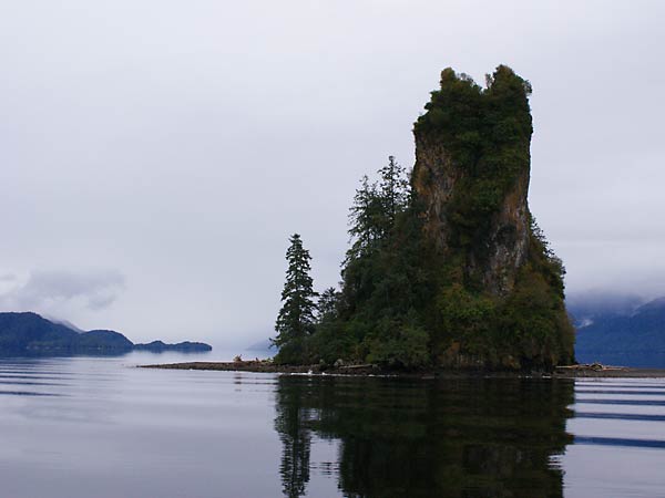
New Eddystone Rock rises 237 feet above the water. The rock is lava
from a volcanic core; softer rock around it eroded away during the last
ice age, leaving the harder rock standing.
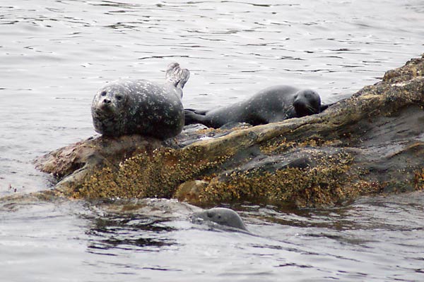
Harbor seals on the rocks at the edge of the Misty Fjords.
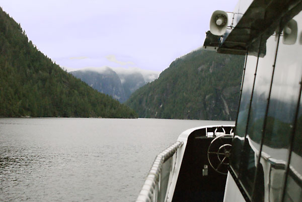
Heading into the Misty Fjords National Monument. The fjords are
well-named; the weather is quite misty, obscuring the tops of the
granite cliffs, which rise as high as 3000 feet above the water. A
fjord is a glacier-carved valley filled with sea water. The landscape
here is truly rugged.
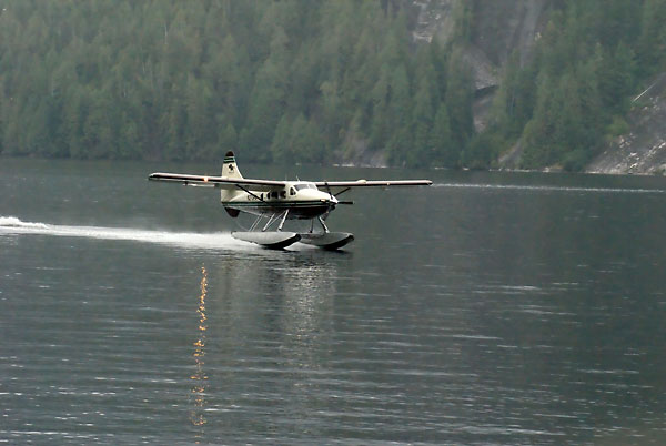
There are two ways you can do this sightseeing trip. One is to take a
boat round-trip. The other is to take a boat one way and fly the other
way. We chose to take the boat both ways because (1) we didn't think you
would see much from the air, with it being so cloudy, and (2) it was
cheaper. The other passengers had a deadline for getting back to their
cruise ships, so they opted to fly back. This float plane is coming in
to pick them up.
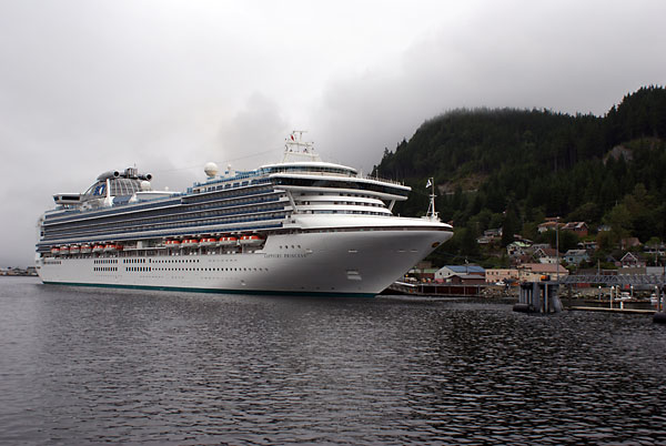
A cruise ship at the Ketchikan dock. Most of the cruise ships left
about dinner time, causing the town to appear deserted in the
evening.
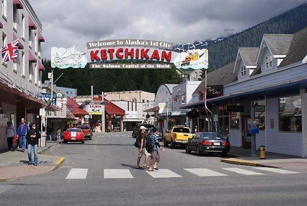
Downtown Ketchikan is right alongside the cruise ship docks. The area
is dominated by gift shops and jewelry store. I haven't been able to
figure out why people would come to Alaska to buy jewelry, but it must
be a lucrative business, or there wouldn't be so many of them. Cities
such as Skagway and Ketchikan, which cater to the cruise ship
passengers, tend to be strange places. They are very busy during the
day when a cruise ship is in town, but become rather deserted as the
cruise ships depart at dinner time. Consequently, the cities tend to
not have many hotels or good dinner restaurants, since everyone is back
on their ship by dinnertime.
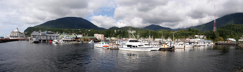
Ketchikan harbor. This picture was taken our second day there. It was a
sunny day - our second sunny day in the last two weeks. In fact, we had
two good sunny days in Ketchikan. Not bad for what is supposed to be
the rainiest place in Alaska.
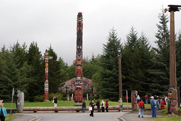
The totem park at Saxman, a couple of miles south of Ketchikan. The
park is very nice, although the clan house in the background is not
open if you come here on your own. To get into the clan house you have
to be on an organized tour. For a $3 fee, they will let you
wander around the grounds and look at the totem poles.
The first pole to the right of the central totem pole is a ridcule
pole. In this case it is ridiculing William Seward, who negotiated the
purchase of Alaska from Russia.
The story is that Seward visited the area and was treated as an honored
guest and given gifts by the Tlingits. In Tlingit customs, honored
guests are expected to give gifts in return, but Seward didn't do so (
I guess someone forgot to tell him about the custom). So the Tlingits
were insulted and erected this pole as their way of gettting even; the
red nose and ears indicate stinginess.
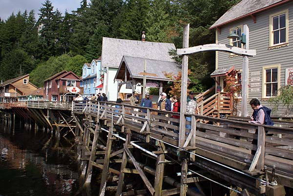
Creek St. was the red light district in Ketchikan until prostitution
was outlawed in 1952. The area is now almost completely gift shops. The
street lies along Ketchikan creek, which runs right through present-day
Ketchikan.
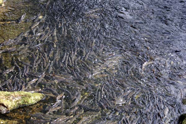
The salmon were running in Ketchikan creek while we were there. This particular pool in
the creek is thick with salmon, apparently resting before attempting to
swim up the rapids and jump the falls.
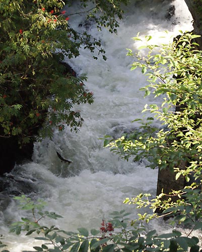
A bit further upstream was this waterfall where salmon were attempting
to jump their way up. A fish ladder had been constructed along side the
waterfall, providing an easier path to get above the falls, but some
salmon chose to do it the hard way.
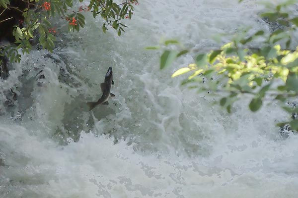
A close-up view of a salmon jumping the falls.
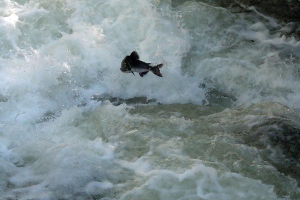
A bridge above the falls allowed us to look down and get a different
view of the salmon. This guy made a valiant attempt. Once their jump
ended in water, we couldn't see where they went, so we don't know how
many were successful at getting over the falls that way. There were
salmon above the falls; maybe those were the smart ones that used the
fish ladder.
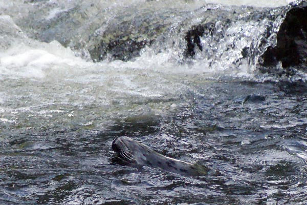
This harbor seal came into the creek to feast on salmon. He just had lunch and looks pretty contented, swimming on his back.
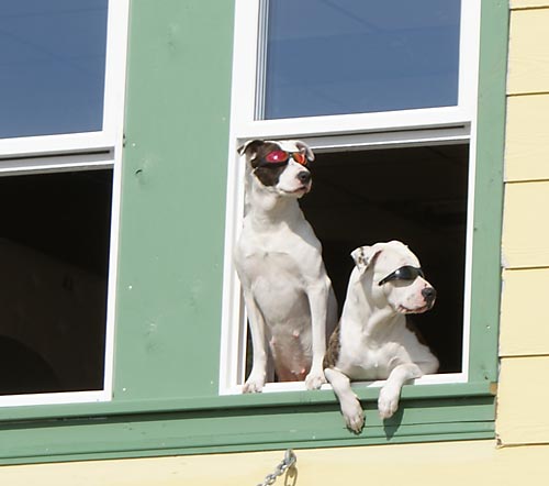
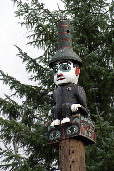
A couple of cool "cats" in Ketchikan.
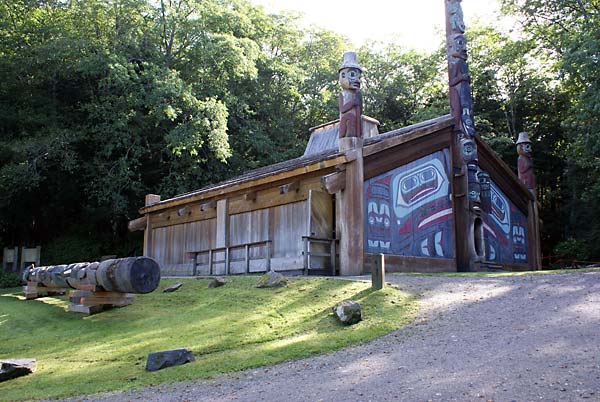
Totem Bight State Park is just a few miles to the north of Ketchikan
and has a good collection of totem poles, as well as a replicated Tlingit clan house that
is open to the public.
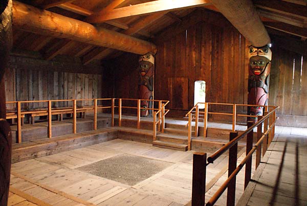
The interior of the clan house. In Tlingit villages, twenty to fifty
people would live in a clan house. In this house, some changes have
been made for accessibility and safety. The railing,
stairway, side door, filled-in firepit, and the enlarged central
doorway are not authentic, but have been put in for safety and
accessibility. In a traditional clan house, the doorway is small, about
four feet high.
A pair of eagles took up residence in the Totem Bight State Park. When
we were there, this juvenile eagle was in the nest while the parents
were off somewhere else.
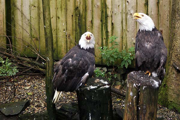
The Tribal Fish Hatchery and Eagle Center in Ketchikan has a couple of
eagles that have been injured and can no longer fly, so
they are permanent residents of the center. They chose to "serenade"
us; the sound they make is really strange and rather raucous.
Tomorrow we head for Prince Rupert - the last leg of our journey by
ferry. Prince Rupert is in British Columbia; we drive from there back
to the lower 48 states.