Whitehorse to Skagway
Aug. 20-22, 2008
At Whitehorse we turned on to the South Klondike Highway; this was our
first time on this road, so we were seeing something new to us.
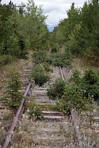
The tracks of the White Pass & Yukon (WP & Y) narrow gauge
railroad that was built in 1899-1900 to go from Skagway to Whitehorse.
The railroad was discontinued in 1982, although the segment from
Skagway to Lake Bennett was restarted as a tourist railroad since then.
The forest is reclaiming the segment of the railroad from Lake Bennett
to Whitehorse.
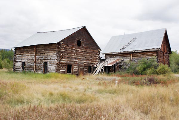
The Robinson flag station and roadhouse served this part of the WP&Y RR until 1982.
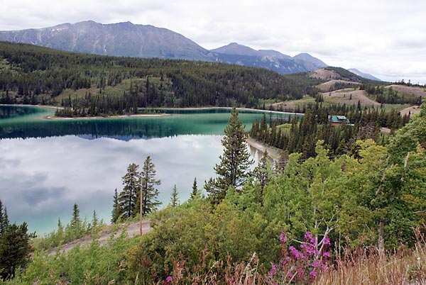
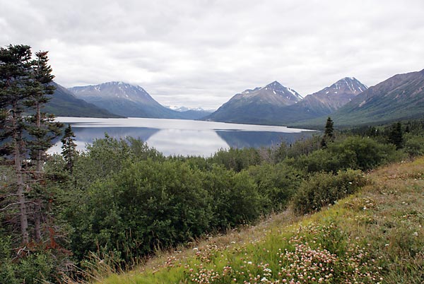
The aptly named Emerald Lake. A layer of marl, cacium carbonate clay,
on the lake bed reflects the blue-green part of the sunlight spectrum,
giving it the emerald color. The lake plus the surrounding mountains
made this a very scenic place to live. I wonder how much they would
sell that house for down there near the lake?
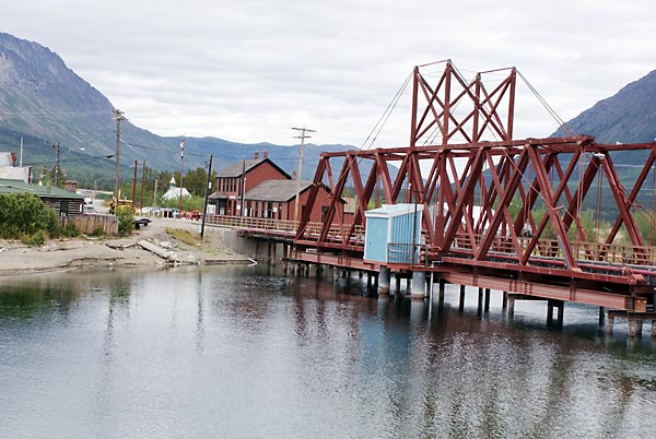
Our next stop was at Carcross, which is at the north end of Lake
Bennett, where it connects with Nare's Lake. People stampeding to the
Klondike goldrush floated through here on boats on their way to Dawson
City. The train station has a neat display of old historical photos of
the era.
From Carcross the South Klondike highway follows the shoreline of
Nare's Lake and then Tutshi (pronounced "two-shy") Lake on its way to
Skagway. The government campground in Carcross was pretty grim, so we
headed on and found a nice place to park for the night - at a boat
launch on Tutshi Lake. We were right next to the water and had a
beautiful view; the price was also right (free).
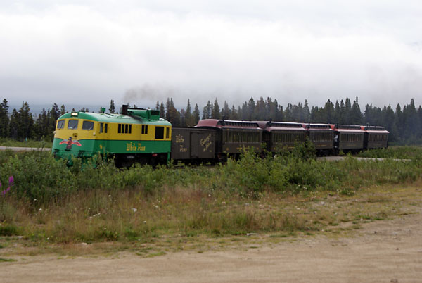
The next day we headed on. This White Pass & Yukon train had come
up from Skagway to Fraser. I felt sorry for the tourists on it; the
mountains were socked in and they didn't get to see any of the
beautiful views in going through the pass.
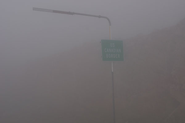
The U.S. - Canadian border at White Pass. We didn't get to see any
views either. It was really foggy. Once we got below the fog, it was
rain all the way to Skagway.
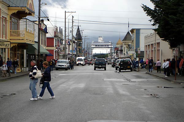
Looking down the main street of Skagway, I was struck by the sight of a
cruise ship in the harbor. It looked like it was coming right up the
street.
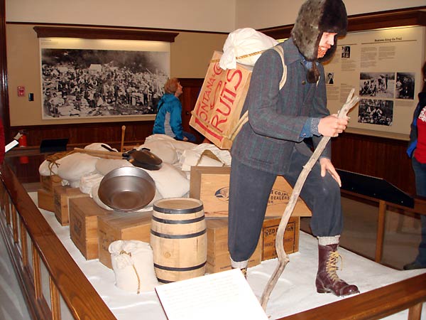
Skagway really promotes its history as an access point to the Klondike
gold rush. This display in the National Park Service Visitor Center
shows the load of stuff that stampeders had to take with them across
the mountains to get to Dawson City. The RCMP required that they have
enough food and supplies to last them one year.
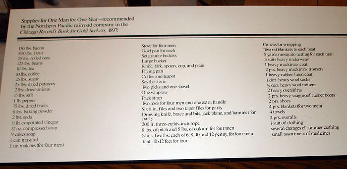
The list of recommended supplies for one person. The weight was about a
ton. Image carrying this across the rather difficult Chilkoot Pass or
White Pass, the two routes they used. It would have taken them many
trips with heavy loads. It has been estimated that they walked a
thousand miles to get their load to Lake Bennett, which is 33 miles
away. At Lake Bennett, they built boats and floated through lakes
and down the Yukon River to get to Dawson City.
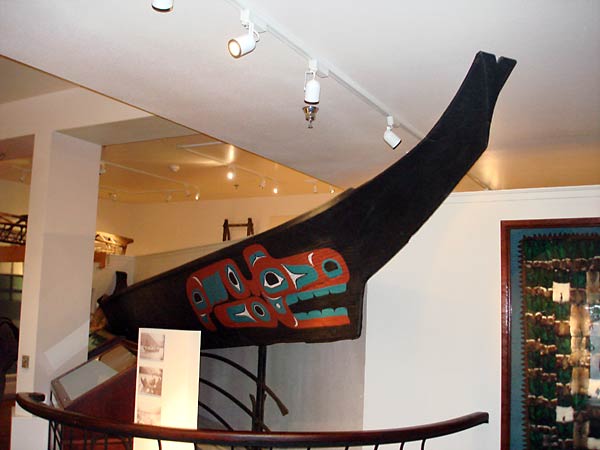
The City of Skagway has a small, but very nice museum. This is a Tlingit canoe; we are now in Tlingit country.
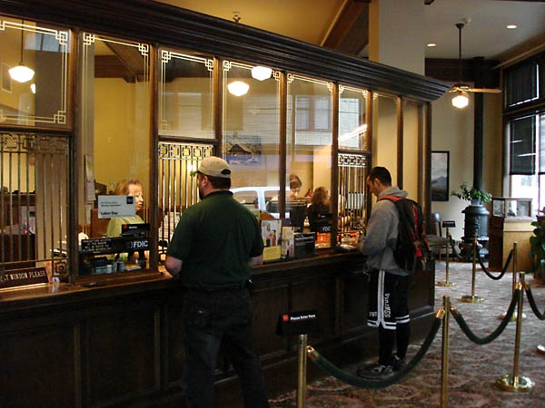
Even the Wells Fargo bank in Skagway had an old-fashioned looking bank with these teller windows. Very elegant.